
An 18-month project developing farm-specific nutrient profiles and 48 customised Farm Environment Plans has seen Rerewhakaaitu farmers taking practical steps to protect water quality in their local lakes.
Working with Bay of Plenty Regional Council, Fonterra, Beef+Lamb NZ, AgFirst and PerrinAg the FEPs will help the farmers minimise nitrogen and phosphorus losses to waterways.
The project involved farmers in the catchments of Lakes Rotomahana, Okareka, Okaro, Rotokakahi, Rerewhakaaitu and Tarawera, plus adjoining farms in the Rangitaiki and Waikato River catchments.
Project Rerewhakaaitu is the farmer group at the centre of the project. Chairman Chris Sutton says local farmers have been working together since the early-2000s because they wanted to take the lead in protecting our local lakes. “This latest project helps us work alongside industry and regional council so each farmer gets their own customised FEP with an Overseer assessment of their ‘nutrient footprint’,” says Chris.
Understand our footprint
“We know nutrient rules might affect our farmers one day, so it’s best we understand our footprint and have a set of actions farmers can implement on-farm. We also agreed to share the average nutrient loss data with regional council so they can advance the wider catchment modelling work.”
Andrew Kempson from Fonterra’s Sustainable Dairying Programme says they were keen to trial their new farm plan system, Tiaki, in an area with no on-farm nutrient limits to help farmers stay ahead of the game voluntarily.
“Tiaki farm plans also consider sediment and bacterial losses and how to reduce them,” says Andrew.
“Fonterra staff have worked with 32 dairy farmers, covering a bit more than 5000ha. Collectively, there were 1060 on-farm actions identified in the new Tiaki farm plans across the Tarawera lakes catchments. “We were also able to compare nutrient losses between land use, soil types and the different catchments.”
Beef+Lamb NZ environmental policy manager Corina Jordan says its national sustainability strategy, released in 2018, strongly promotes use of FEPs.
They’ve been promoting farm plans for more than 10 years, since developing their three-level Land and Environment Plans or LEPs, says Corina.
“We helped start the Tarawera project by running two LEP workshops and once farm consultants had prepared the plans, we collated the nutrient data across the 16 participating sheep and beef farmers.
“One interesting result was that while nitrogen loss rates were linked to stocking rate, phosphorus losses were more influenced by soil type. This kind of data will help the ongoing target cost-effective of nutrient mitigations.”
“Another interesting result to come out of the work is the degree of native vegetation and areas of non-pastoral land within these mixed and diverse sheep and beef farming systems, with overall around 19 per cent or 1280ha of the farmed area being set aside for the provision of other values such as biodiversity values.”
Complex system
BOPRC Rotorua catchments manager Helen Creagh says there is a complex system of water and nutrient movement between the seven lakes that feed Lake Tarawera, some of which are not meeting the water quality targets set in the council’s regional plan.
“To identify what nutrients are affecting which lake, we need to build a catchment model. Good farm nutrient data is essential to help drive that model.”
BOPRC is keen to keep working with farmers in the Tarawera Lakes catchments. “We can provide advice and funding support for many of the actions identified in the farm plans,” says Helen.
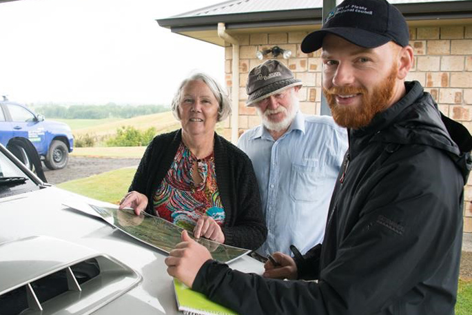
BOPRC land management officer Colin Bates recently visited Dick and Gaylene Brough’s property for an on-farm visit and was amazed at the enthusiasm and strong level of commitment to the FEP that had been developed.
“A large part of each FEP is the identification of CSAs – critical source areas for phosphorous loss.
“These areas can be broadly described as the interception of overland water flow with soil,” says Colin.
“During my visit to Dick and Gaylene’s property we looked at various seepage springs, erodible ephemeral flow paths and head-wall gullies, we discussed practical solutions to mitigate CSAs and funding available for the retirement of vulnerable land.”
0 Comments
Leave a Comment